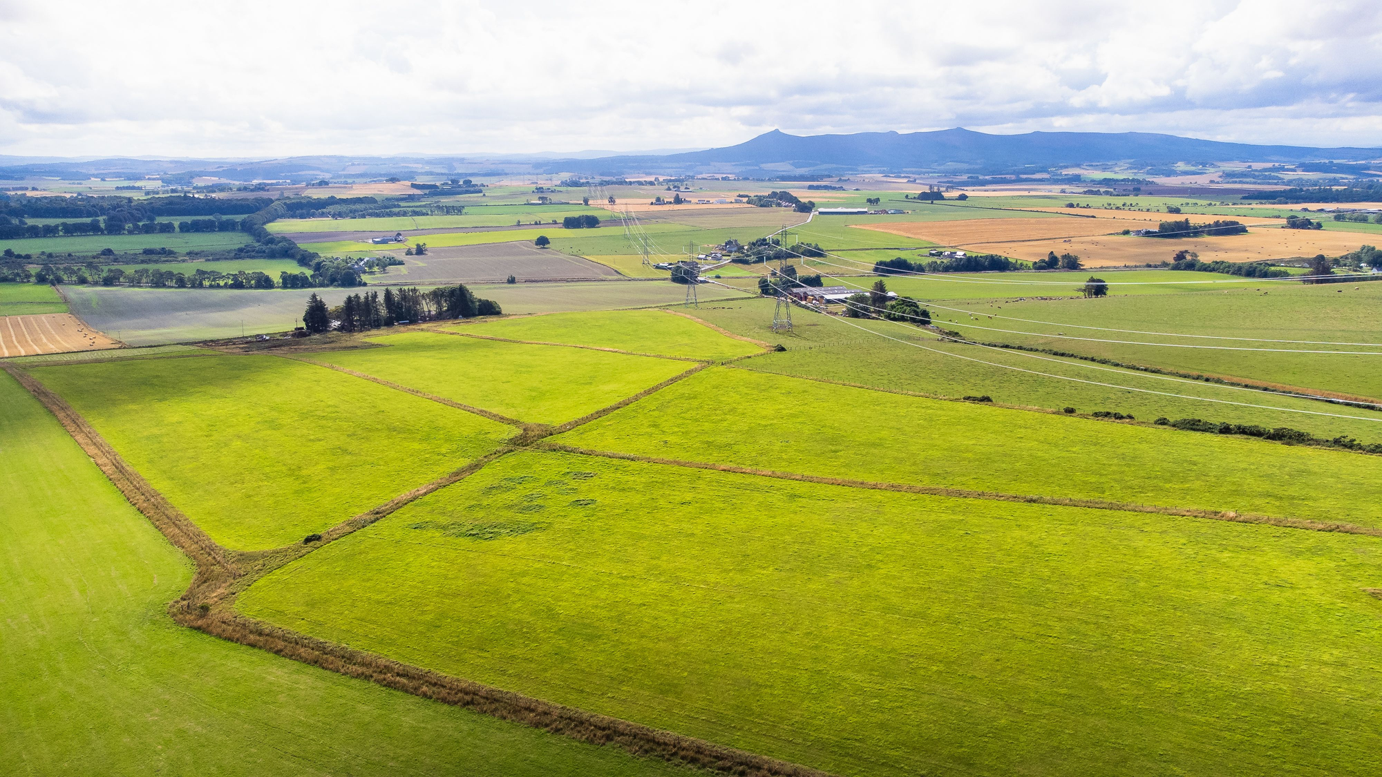
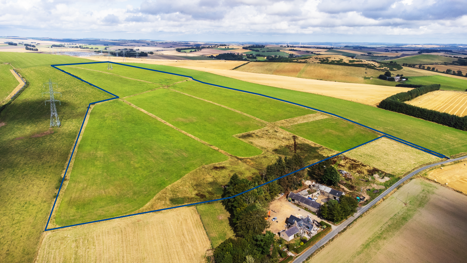
Productive Grade 3(2) south facing agricultural land near Rothienorman extending to 13.43Ha (33.2 acres) or thereby. For sale as a whole.
Land at Knowley
Land
Land at Knowley, Meikle Wartle, Inverurie
Offers Over £120,000
Description
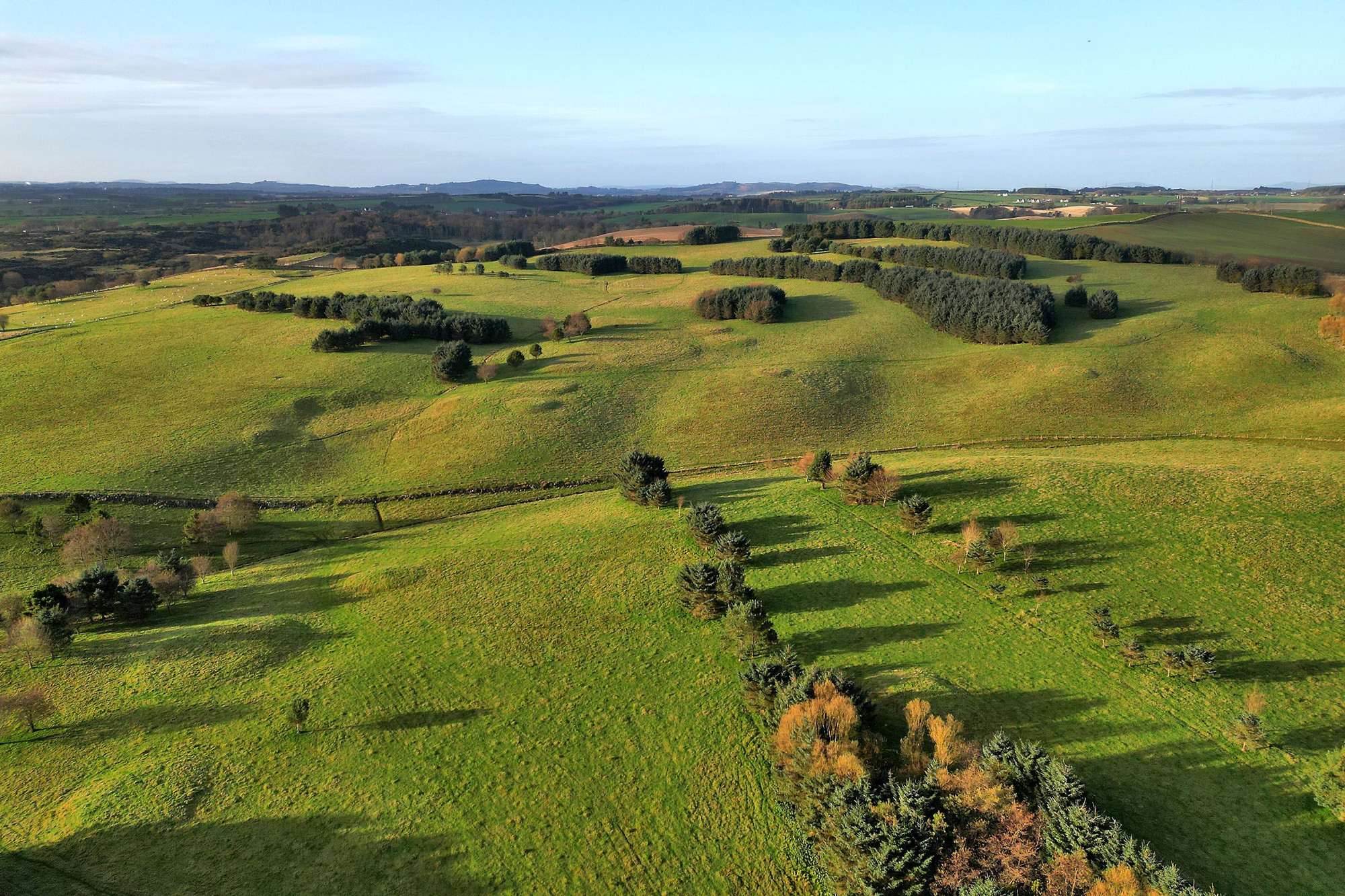
The land at Knowley is situated in a productive and accessible agricultural area to the south-west of Rothienorman in Aberdeenshire sitting approximately 4 miles east of the A96. The land lies adjacent a minor road branching off the A920 which provides good links to the A96, Oldmeldrum and onwards to Inverurie. The land has a south-easterly facing aspect and is classified as Grade 3(2) by the Macaulay Institute for Soil Research (now the James Hutton Institute).
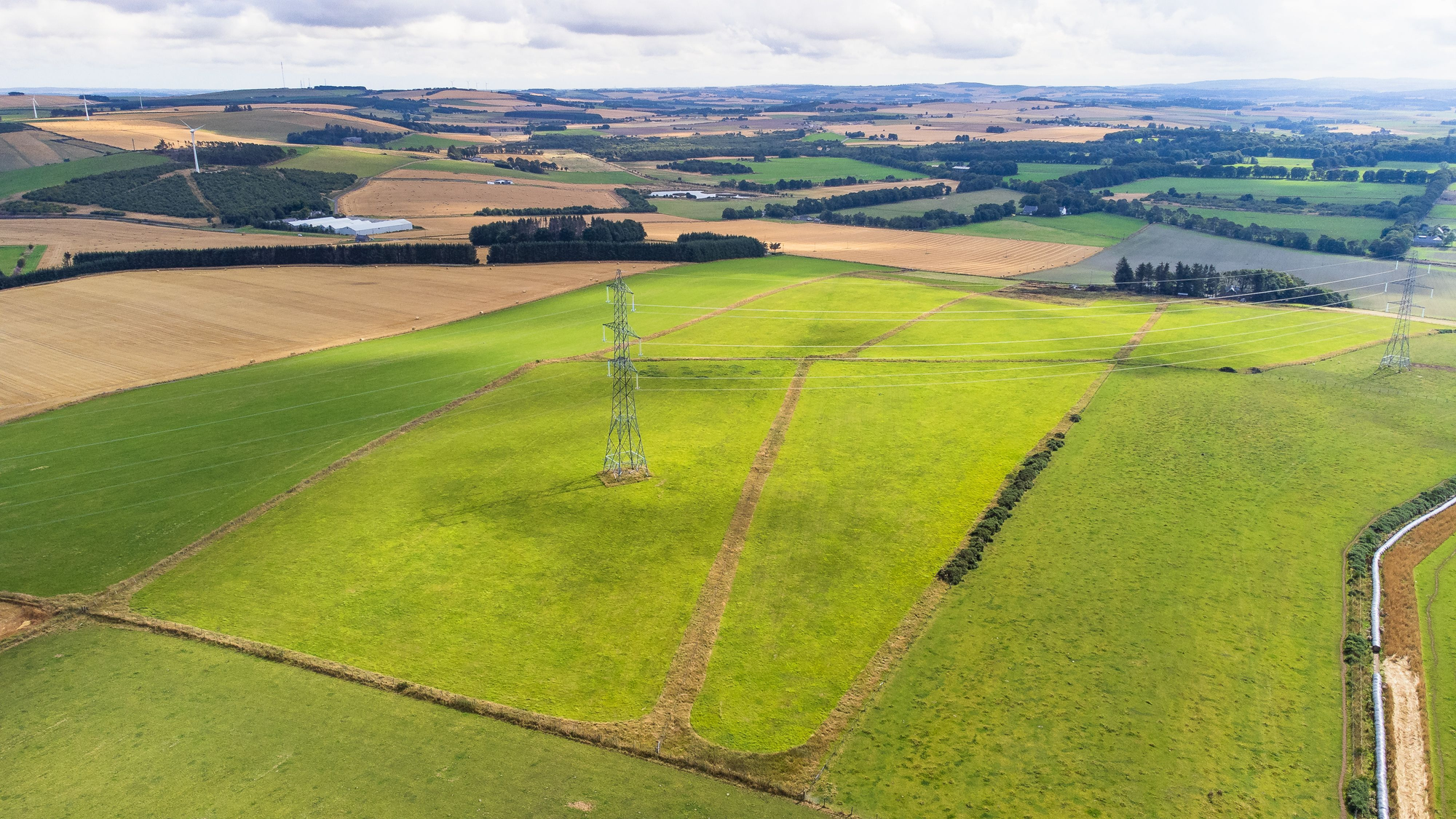
The land comprises 7no IACS registered field parcels extending to 13.4Ha (33.2 acres) or thereby in total as per below table. The land is currently sown in grass.
Pylon
There is a lattice (transmission tower) electricity pylon in field 2.
| Field | Field Identifier | Ha | Acres |
|---|---|---|---|
| 1 | NJ/69700/33742 | 2.06 | 5.09 |
| 2 | NJ/69727/33830 | 2.60 | 6.42 |
| 3 | NJ/69821/33396 | 2.61 | 6.45 |
| 4* | NJ/69886/33515 | 2.94 | 7.26 |
| 5 | NJ/69922/33647 | 2.32 | 5.73 |
| 6 | NJ/69902/33373 | 0.17 | 0.42 |
| 7* | NJ/70031/33465 | 0.73 | 1.80 |
| *estimated | Total | 13.43 | 33.17 |
Entry
By arrangement.
BPS Entitlements / LFASS
Entitlements are not included in the sale. BPS Region 2. All NLFA.
Offers
Offers should be submitted in full Scottish legal terms to this office along with anti-money-laundering ID paperwork.
Note
Prospective purchasers should note that unless their interest is formally intimated to the selling agents following inspection, the agents cannot guarantee that notice of a closing date for offers will be advised and consequently
Contact Our Agent
Director
01467 623800
estates@anmgroup.co.uk

View More Properties
View All
Land
Rothiemay
Land at Clashman Hillock & Lower Woodside
Productive grade 3(1) and 3(2) land extending to 76 acres or thereby, enjoying good roadside access and a south-east facing aspect next to the River Deveron.
Acreage
75.73
Available in
2 Lots
Offers Over
£380,000
Development
Huntly
Development Land at Castle Terrace, Rothiemay
Attractive and secluded housing development site for 10 houses in the quaint riverside village of Rothiemay.
Offers Over
£250,000
Land
Balmedie
Land at Millden
Once-in-a-lifetime opportunity to secure a former golf course - a unique and attractive site in a sought-after location close to the village of Balmedie.
Acreage
62
Offers Over
£465,000
Contact Us
Thainstone Agricultural Centre, A96, Inverurie AB51 5XZ